May 29
Idyllwild Campground to Little Round Valley Camp + Peak of Mt. San Jacinto
12 miles
Here’s where the mileage will get goofy because I am *gasp* skipping some PCT miles. Because of the hitch miles and a fire closure and going off trail to climb Jacinto, my miles will no longer correspond to the pct mileage and everything from here on north is probably a complete guess.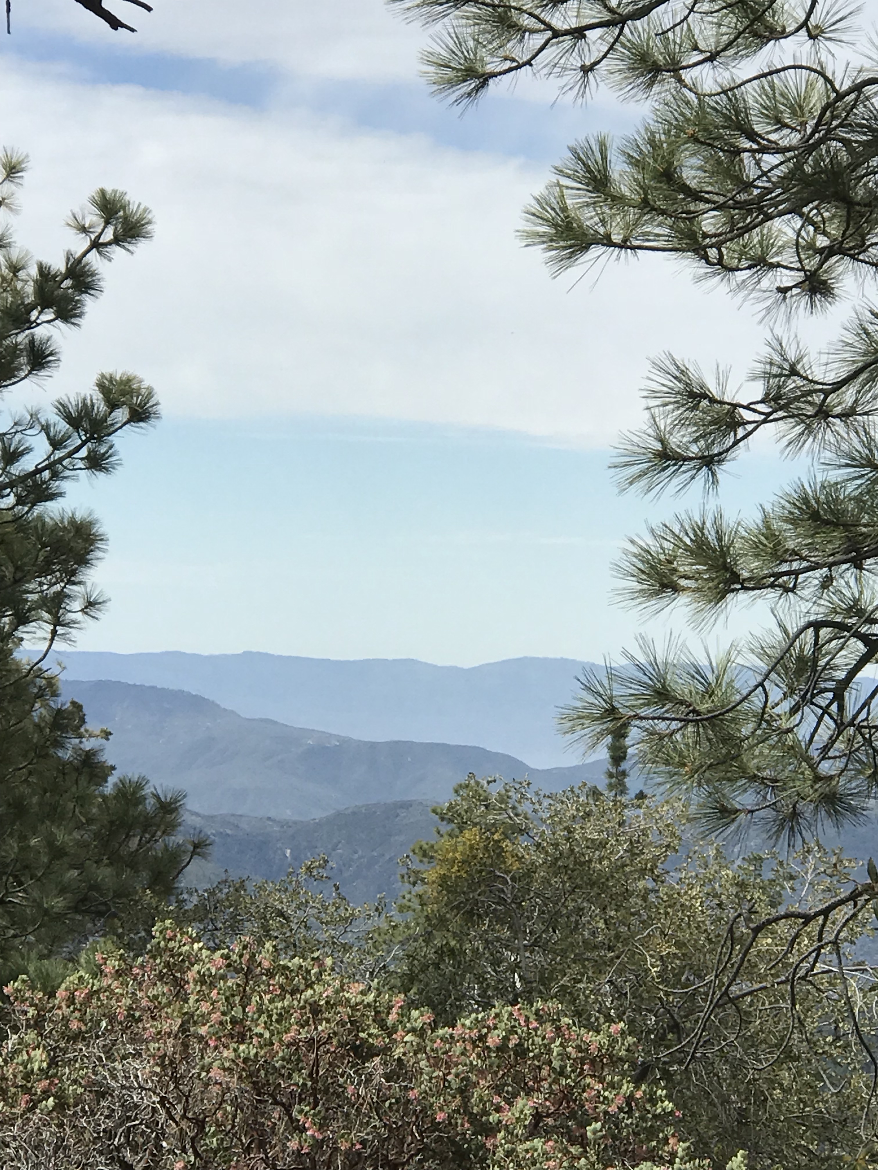
I didn’t leave the campground very early. After one day of not hiking, every single item I carried seemed to have been removed from its container. It took forever to get everything all squashed back together. My food bag was out of control. Beyond all the normal camping food supplies, I also carried a round loaf of bread and half of a carne asada super burrito. You know, in case I needed a snack on my way up the mountain.
Mt San Jacinto looks like a place where snow lives. I could picture all the pine trees and boulders and manzanita blanketed in white. The climb activated all new muscles. I had to climb blown over trees and boulders. The paths were lined with scratchy bushes – wrong day to wear shorts. I can’t imagine how difficult this path would be with snow added.
Trail goes up and up relentlessly. My shoulder hurt more than my legs. I passed truck sized boulders splattered with blobs of multicolored lichen. My trail runners kicked through drifts of small pine cones. I got a blob of sap on my backpack and then it got on my hand.
Oh yeah, and so many annoying flies! The tiny buzzy kind that hang around your eyes or ears and refuse to be batted away.
The mountainside is dotted with these great big lumpy red trees with deep cracked dinosaur skin bark. Cypress or cedar, I’m not sure. The path tumbled over boulders, especially towards the top. You can see the summit looming ahead, getting closer and closer. There were a couple of long brutal climbs with views of long hot climbs ahead, that’s fun. I like walking uphill and I think my bike muscles might be helping a little. I felt quite strong on the uphill, although I still took plenty of breaks. Picture breaks, mostly, because each corner revealed another staggering view that required photo documentation. There’s a bit of a rock scramble to get to the top. I understand that there’s a tram somewhere but I saw no sign of it. Come to think of it, maybe that’s why the pictures I see of Mt. San Jacinto seem to show two different places. When I got to the top, I didn’t see a flagpole. Maybe the flagpole is over by the tram. I wonder what kind of tram it is? The trams up mountains in Japan were the niftiest slanty train cars. 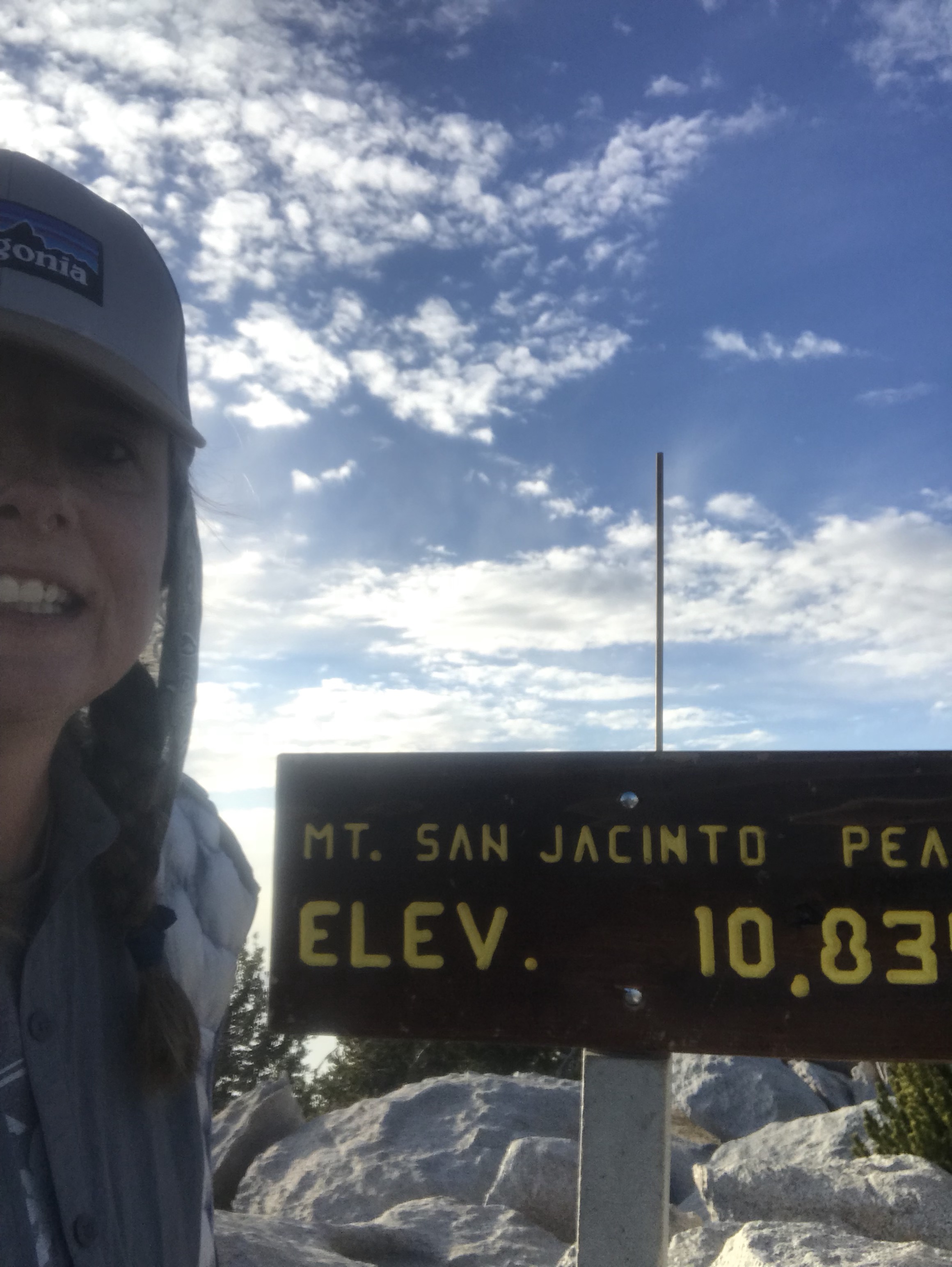
The peak is at 10,834 feet and you can see so so far. Row upon row of windmills down in the San Bernardino Pass. It was an hour before sunset when I got to the top. Part of me wanted to stay for sunset but I thought that could backfire.
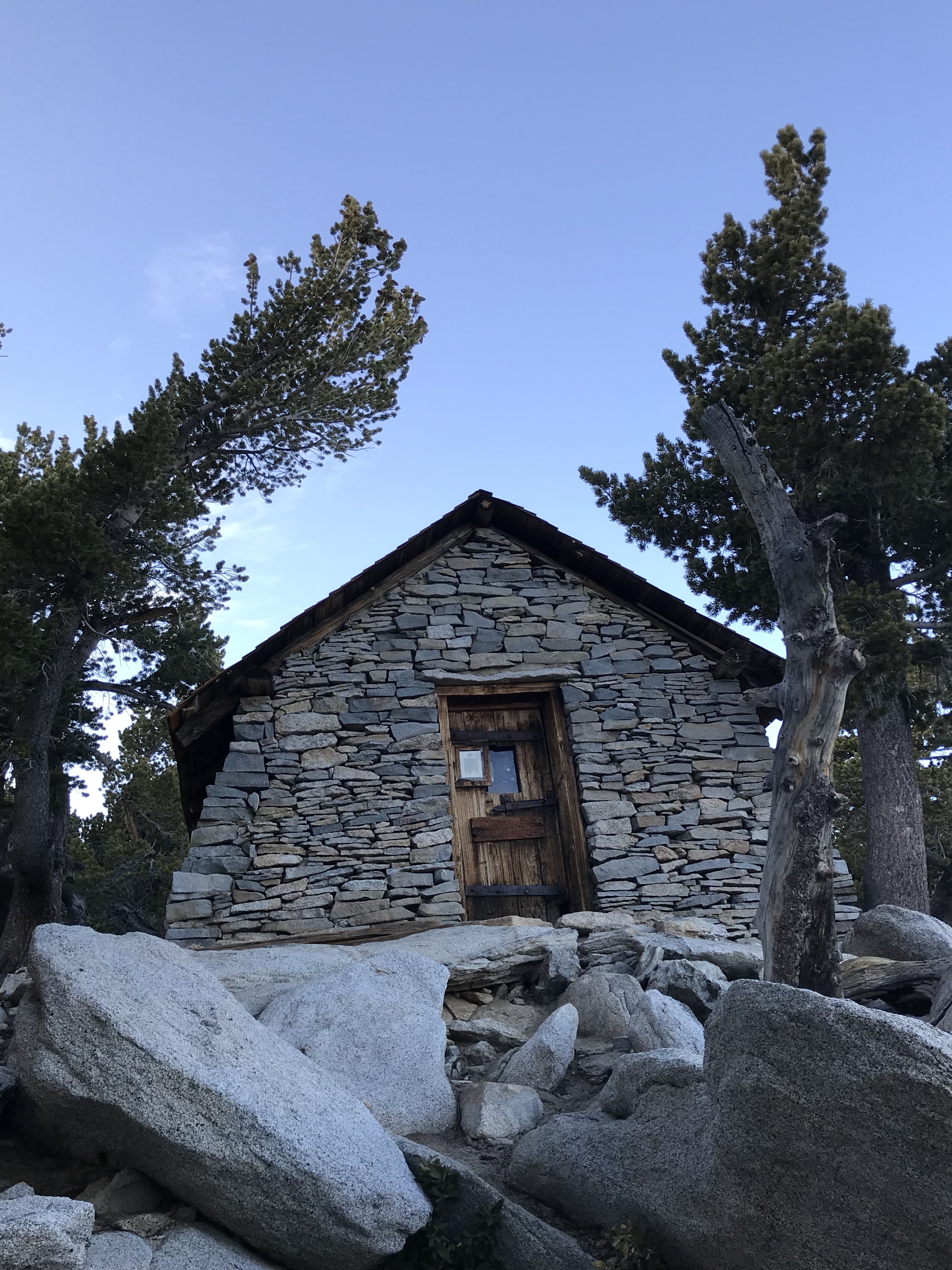 There’s a stone hut at the top. A place to wait out a sudden snowstorm. Inside there are bunk beds with space blankets. Random emergency supplies. It’s all very snowbound in the wilderness romantic adventure.
I walked down the west side of the mountain, so the sunset was peeking through the trees. Once it got dark, it got cold. I stumped down the trail with my headlamp in the dark, trying really hard not to stumble. Any bit of level ground was covered with pine cones and rocks. Following the rule that all good campsites become invisible when you’re looking to camp. My descent down the dark mountainside felt much longer than the mile it says on the map. There’s a large campground space full of sites that look almost level. I put on my rainfly and all my bed clothes but it promised to be a chilly night under the full moon.
